Asset identification

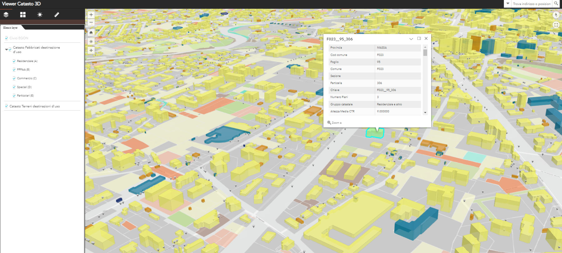
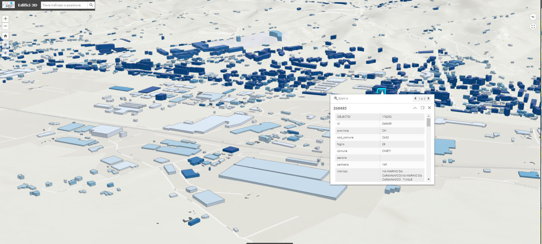
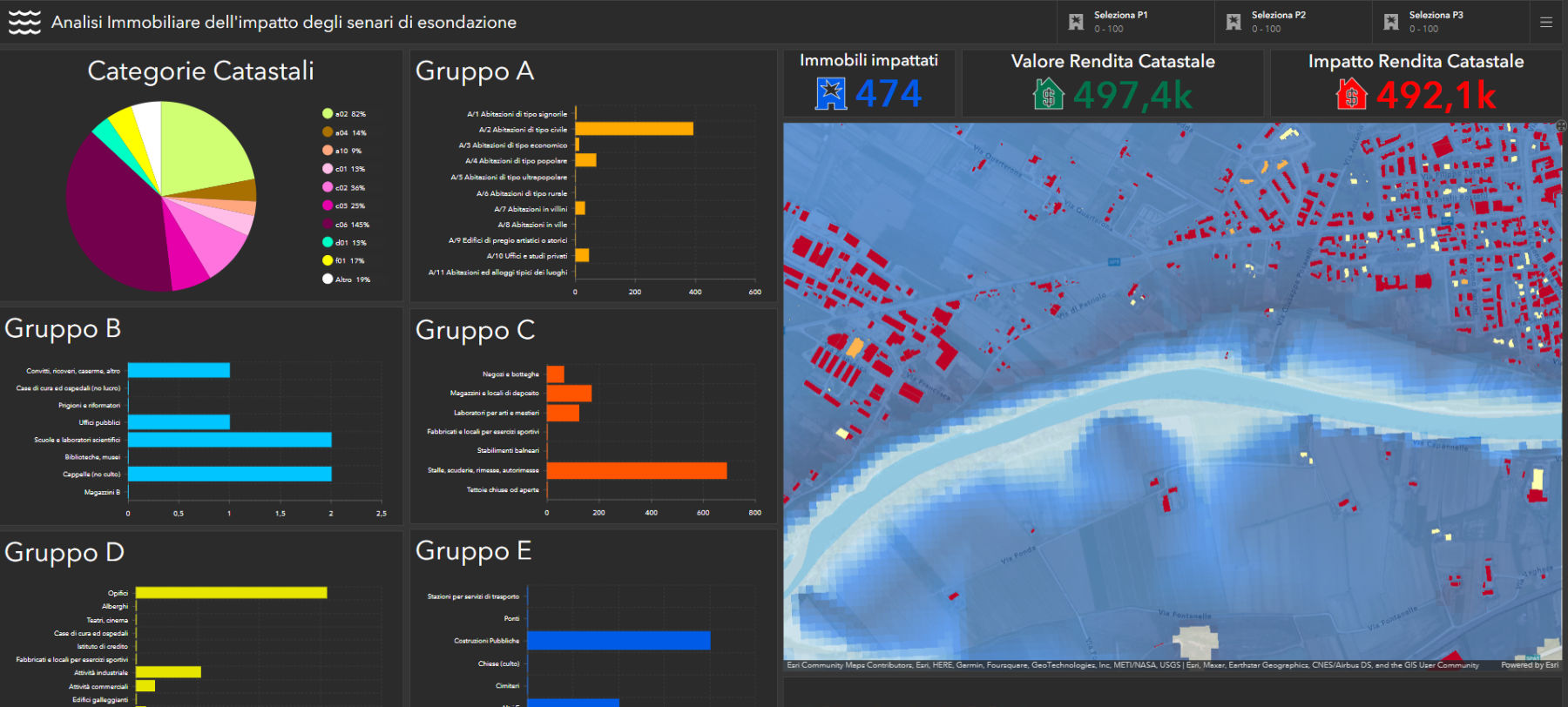
The asset identification service aggregates different data sources to provide an overall picture of the areas of interest. The analysis is based on the geolocalization of all information, providing a complete picture with all the significant aspects for prudent management.

The associated services range from simple cadastral geolocation to complete asset geomarketing with recurring satellite survey and environmental and anthropogenic risk assessment

Reference markets

Fintech

Insurance

Real estate

Infrastrutture

Take advantage of our experience to optimize your investments and operations.

UrbyVal, descriptor, identifier and asset enhancer.
National coverage.

Urby-val is a cloud analysis system to help with real estate valuation. The system aggregates different data sources to provide an overall picture of the area of ​​interest. The analysis is based on the geolocation of all the information present in the system.

Extraction of geometric, econometric, historical, environmental and social characteristics that determine the value of assets, In favor of prudent management and profitable investments.